Not sure, how off topic this actually is, but since it's partly outside of Opus, i'd rather ask here.
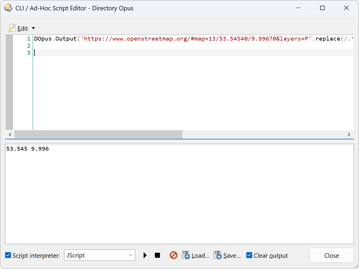
My request is about having an URL clipped down to just the bold parts in the format
xx.xxx xx.xxx or xx.xxx xx.xxx, so there's a blank space between the coords.
I have altered the URL a bit to prevent the forum software making it into a preview, but basically i would like to have just that pair of coordinates left, shortened to the third digit after the decimal.
I'm doing it manually at the moment, but i'm sure, that the powerful REGEX (and someone of you guys) is capable of achieving it, since it can also do things like even computing Pi (not the whole number of course, only Chuck Norris could do that). Any help very much appreciated.
Works great! Thanks a lot. Integrates well into aussieboykie's FileTags. Which has a similar function, only that it refers to already existing coordinates in images. The script you provided is more for "hey, for this exact location, do i have more images here?". If i then feed the coords pair into FileTags, it can look that up for me, from Firefox.
FileTags could get an URL import function that accepts complete URLs and extracts the coordinates for the lookup. The regex could be enhanced to also work for other services like Google Maps.
That would be an idea, but FileTags is already feature packed to the brim, and this seemed to me almost a bit out of scope. There's also the Everything search involved, to search my large image collection for all the coordinates. Very neat, how all those components work together, like cogs in a machine. Not to forget Directory Opus as the "mother ship" around all those parts.
I see. The quickest way would be to let the bookmarklet generate a command that can be pasted into the Everything window. Alternatively, Opus could take the URL and launch Everything with it.
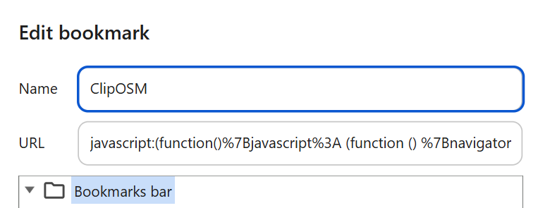
Yes, there are a couple of ways to use it. Could you maybe do me the favor to change it to the form of latitude:53.545 longitude:9.941, so i wouldn't even need to edit FileTags input line? It is a function, that i don't even use that often, only when i want to check points out in the country side where there are no known landmarks to get an idea, if i had taken photos there. But a decent swiss army knife has tools for the most unusual use cases.
Yes, that's even the finer resolution. It represents maybe a 300 Meter radius. Sometimes i even use a coarser two digit radius that amounts to around 1000 Meters or similar. And in case i try other resolutions, FileTags offers six different levels of resolution, with my two standard values sitting at level three and four.
While the finer levels are mostly too precise, returning zero hits most of the time, the coarser levels make a lot of sense for photographers, who are moving around on larger scales, like hundreds or even thousand kilometers. My own sessions are within a range of 50 km distance, which is enough for me and my bicycle.
I have made a second bookmark for the "two after decimal digit version", having changed both 1,3 parts, in case i don't catch enough images. In my test the finer version returned 3 images, while the other found 174.